Week 12 – Summary

I was a little apprehensive about jumping head first into the Digital Cities module when I first enrolled in this MA, as I thought it would not be the best way to start my journey through Digital Media, Culture and Society, but now I am so glad I did. This module reflects exactly what is happening around me right now, as my work is related to Infrastructure for development. How does digital media intertwine with our cities? How do our cities embed digital media? How are cities now planned around digitalization? How does digitalization address real issues, with real people in real cities? There are so many questions presented to us through this module that I had never even thought of asking, and the answers to those questions are just as surprising and enriching.

Our first introduction to Smart Cities was through Anthony Townsend (2013). His definition of smart cities as “places where information technology is combined with infrastructure, architecture, everyday objects, and even our bodies to address social, economic, and environmental problems.(…) We need to empower ourselves to build future cities organically, from the bottom up, and do it in time to save ourselves from climate change.” (Townsend, 2013, page 18)

This made things click for me and made me understand what this module was about. We will be looking at innovations in digital media and the many ways we can engage with cities through technology, but we will also be looking into case studies to understand how things should and should not be implemented, as well as all the stakeholders involved in the making of a digital city.

Unfortunately, I was not able to join the class for the Arup field trip, but I was lucky enough to go to Arup on duty travel and see first hand how innovative and forward-thinking these “bunch of engineers” are when it comes to approaching projects from a digital lens.

We looked into policing technologies through Sadowski, in The Spectrum of Control (2015). We analyzed Code/Space understanding it “occurs when software and the spatiality of everyday life become mutually constituted, that is, produced through one another. Here, spatiality is the product of code, and the code exists primarily in order to produce a particular spatiality.” (Kitchin, R. & Dodge, M., 2011, page 16). We had fun with locative narrative and gaming. We wondered at how cities use dashboards to analyze, manage, and plan. We looked at the many uses and implementations of drone technology, from surveillance to actual delivery of products. We marveled at the potential of 3-D printing.

All of this newly acquired knowledge, for me, culminated in one of our last lessons regarding Sustainability. The SDGs are a big part of my daily work and the fact that countries are harnessing the power of digital media to address sustainable development goal targets is what inspired me to decide on the topic of my final assessment. I look forward to completing this assignment and sharing it within my colleagues as well, mostly engineers, mostly male, who would benefit from understanding the complexities of digital/smart cities and the complexities around infrastructure beyond the construction aspect.

References:

Week 11: 3-D Printing

“Amazing”. Without fail, every time I learn about a new breakthrough or application of 3-D printing on the news, I actually say that out loud. It truly is astonishing how digital technology is rapidly moving changing our relationship with the physical world.

After reading Fabricated: the new world of 3D printing by Lipson and Kurman (2013), amazing did not cut it anymore. Their description of what 3-D printing is might be the best one I have read until now: “When the platypus was first discovered, explorers thought it was a hoax, that a prankster had somehow stitched together a furry animal with a duck’s bill, webbed feet and a kangaroo’s pouch. 3D printing is the platypus of the manufacturing world, combining the digital precision and repeatability of a factory floor with an artisan’s design freedom.”(Lipson and Kurman, 2013, page 27)

It didn’t take long for a 3-D printing company to use the platypus for their marketing

However, the more I read about 3-D printing, the more my vegan and crunchy inner-self reminds me of the implications of massive printing and its impact on the environment. How much plastic are we talking about here? If excessive plastic is an issue now, with over 300 million tonnes of plastic being produce around the globe every year, imagine what it will be like when every household, business, school and hospital starts printing out plastic objects left and right?

This is why I was so taken by the story in The Guardian about the city of Pune, India, where startup Protoprint is working on converting plastic waste collected from garbage dumps into filaments for 3-D printing companies. Protoprint teamed up with SWaCH, a cooperative made up of local waste pickers, to pilot this initiative and ensure a sustainable approach to waste management. A potential win-win-win for the environment, the local waste pickers who struggle to make ends meet and for those who want to source a cheaper and more sustainable raw material for their 3-D printing.

Lipson and Kurman write about the virtues of 3-D printing, as it seems to provide a good, cheap and fast product, but they do highlight that there are hidden costs, such as the aspect of design, but as the case study describes, the filaments used for printing are quite expensive as well. “Although the word plastic has become a synonym for low-cost materials, 3D printing plastic isn’t cheap. In fact, the cost of plastic printing material quickly adds up to become a significant part of the cost of running a 3D printer.” (Lipson and Kurman, 2013, page 82).

The ethical filament produced from waste products, as opposed to virgin filament, would be cheaper to source, although according to the story, there are some quality and certification issues that need to be ironed out before calling this a complete success. There is also the issue of the manufacturer’s warranty, and how it can be jeopardised if non-proprietary materials are used.

Photo: Aman Trust, in www.downtoearth.org.in

The team of writers address the question, “Will 3-D printing help make jobs?” (Lipson and Kurman, 2013, page 45), and although I am pretty sure they did not have this sustainable development issue in mind when they wrote Fabricated in 2013, other aspects of sustainability were present in their work. As the authors describe, when plastic is born, it never dies. It is here forever. But approaches to make it a more “green, clean manufacturing” (Lipson and Kurman, 2013, page 197) are emerging. Innovative projects like Solar Sintering that use solar energy to power the 3-D printers and sand as the raw material.

Keeping all of these dimensions in mind, and in spite of the Protoprint and SWaCH collaboration still being a work in progress, if successful it could result in good business for 3-D printing, for the marginalised groups of waste pickers and for the environment.

References:

Week 10 Sustainability and Sensing Cities

The post-agenda 2015 goals for sustainable development include amongst there social and economic objetives Goal number 13 that aims to take urgent action to combat climate change and its impacts. This topic has had its fair share of controversy. Climate change deniers do not accept the rising temperatures, rising sea levels and increase of natural disasters are man-made.

Elliot and Urry (2010) swiftly address the deniers with hard facts and a description of how the 20th Century’s capitalism and the advent of mobile lives have resulted in an era of carbon hubris (Elliot and Urry, 2010) which, according to the authors’ four different type of future scenarios, will be forced to come to an end in a few decades to come. Mobile lives, as mentioned, are creating problems – both environmental and social – that will have to be addressed in the 21st Century. People are constantly on the go, connecting with others either physically by travel, or virtually through mobile phones, SMS, skype. “The richer the society, the greater the range of mobility systems that will be present, and the more complex the intersections between such systems” (Elliot and Urry, 2010, page 19). Network capital will define a person’s access to mobility and as with all forms of capital, this freedom of movement becomes unequally distributed.

The case study SavingFood from the Collective Awareness Platforms projects indirectly addresses Goal 13 on Climate Change but most importantly, Goal 2 to end hunger, achieve food security and improved nutrition and promote sustainable agriculture

As mentioned in their website, “SavingFood offers an innovative and socially responsible solution to the food waste challenge by developing an online networked community of various stakeholders that through collective awareness, knowledge sharing, motivations and incentives, will facilitate the redistribution of surplus food and leftover crops for the benefit of the vulnerable groups of our society.”

Elliot and Urry describe four future scenarios, two being preferable (Local sustainability and Digital Networks) and the other two un-preferable (Perpetual Motion and Regional Warlordism). Clearly, SavingFood addresses the first category, taking something from both scenarios. To achieve food security, SavingFood encourages local sustainability by the sourcing of food from the communities, as well as exploiting the power of Digital Networks to share knowledge on the subject.

SavingFood takes advantage of the technological advances of the 20th and 21st centuries -by embracing the internet and digitalization- to address the problems that this progress has helped to create. It is an interesting approach to raise awareness and promote conscientious consumption.

References:

Critical Practice Assessment

My assignment consists of a Critical Practice assessment, based on a whiteboard animation video. It has great potential for storytelling. The video below is the draft version I have so far, and it is missing a voiceover, which is very important to guide the viewer through the story. (I hope you can use your imagination and get the general idea of the script!)

Based on Townsend’s (2013) and Sadowski’s (2015) descriptions of digital cities, I will focus on a few case studies that go beyond the existence of Digital Cities for digitalization-sake. The case studies we analyzed in previous lessons regarding drones is a good example (which I will not repeat here) about the use of digital technology in developing countries, and how digital cities are used as a means to an end. The end being, in this case, the contribution to the achievement of Sustainable Development Goals.

Townsend’s last paragraph from his introduction to smart cities has resonated with me: “I believe there is a better way to build smart cities than to simply call in the engineers. We need to lift up the civic leaders who would show us a different way. We need to empower ourselves to build future cities organically, from the bottom up, and do it in time to save ourselves from climate change.” (Townsend 2013, page 18).

I will focus on one case study, very close to my heart as I was the Project Manager for the content development component of the initiative. In Argentina, the province of San Luis has gone digital by enabling free Wi-Fi for all citizens as well as implementing a “one laptop per child” educational programme in primary schools. This addresses sustainable development goal number 4, Quality Education. It is a good example of a retrofitted and renovated digital city in a developing country, as well as a good example of the multidisciplinary approach needed to make an impact. The involvement of IT engineers, urban planners, ICT professionals and IT suppliers, education experts, pedagogues, sociologists, teachers, government officials, and last but not least, students and families, well are necessary to implement this programme.

The objectives of this assignment will be:

  1. To frame the concept of Digital Cities using Sadowski’s and Townsend’s theories
  2. To link digital cities to the development context through a case study taking place in a developing country
  3. To link the case study to a specific Sustainable Development Goal
  4. To describe the impact of digitalization in development
  5. To highlight the multidisciplinary and multisectoral approach required to ensure the digitlization of a city, especially in a developing country, produces the outcomes and impacts desired.

I was thinking of including a second case study referring to Goal number 9, Industry, Innovation and Infrastructure. However, I noticed that there is a lot more to explore with regards to digital cities and Goal number 4. For example:

  • What roles do the stakeholders mentioned in the video have?
  • What is the role of IT alone in achieving Goal 4?
  • What were the failures and lessons learned from similar initiatives, like the one laptop per child initiative?
  • More references to theory from our weekly assignments
  • Include a video/additional multimedia to the whiteboard to expand Goal 4

Let me know your thoughts!

References:

Week 9 – Drone Technology

How can you connect digital media, digital cities and specifically drone technology to development and aid?

This is how: the case study in Rwanda where unmanned aerial vehicles, infamously known as killing drones, are being used to transport medical equipment and essentials within a country lacking the infrastructure assets and systems needed to ensure proper healthcare. This seems to address Ole B. Jensen’s question on whether or not the emergence of drone technologies “will also hold empowering potential for institutions other than states, government bodies, commercial enterprises and organised crime.” (Jensen 2016, page 67)

The potential is enormous, as drones can support many other needs as evidenced in the pilots taking place in Malawi. According to UNICEF, the emergence of the first humanitarian drone test corridor will allow organizations and individuals the chance to explore the possibilities of unmanned aerial vehicles in the fields of development and aid. The project explores Jensen’s “six dimensions of surveillance” (Jensen 2016, page 71) through the use of drones for capturing aerial imagery, but goes beyond this as it focuses on the transport and delivery of medical supplies, vaccines and laboratory samples.

As usual, with every innovation and the excitement that it brings, there are risks and challenges to look into, not only to do with design constraints but with lack of proper regulation. The UNICEF project addresses this by establishing a corridor in consultation with the Malawi Department of Civil Aviation, abiding to their the government’s regulatory framework.

Perhaps the most dangerous aspect with regards to the overuse of unmanned vehicles when facing development and humanitarian issues is the fact that we are not addressing the root issues which are inadequate healthcare systems and road infrastructures. The use of drones might very well support the targets of sustainable development goals such as number 3 Ensure healthy lives and promote well-being for all at all ages. But what about number 9, Build resilient infrastructure, promote inclusive and sustainable industrialization and foster innovation? Aside from the last component of innovation, the use of drones might not doing number SDG 9 any favours. UNICEF would argue that their mandate is to protect children, and that they are doing just that. As long as the outputs and outcomes are clear, the use if innovative technologies like unmanned aerial vehicles has incredible potential in the development and humanitarian fields.

References:

Week 8 – Digital Urban Gaming

The speed of the IoT is truly astonishing. I remember the first time I heard about Pokémon GO and finding the whole concept mind-blowing, having even trouble wrapping my head around the fact that little monsters were coexisting with us, in a digital world that was invisible to the naked eye, unless we used an app to make them come to life. “But who put them there? Why is one in my bathroom!?”

Everyone was into it. It was everywhere. Even Maroon 5 made a ridiculous video about it:

I never joined in on the fun, but enjoyed living vicariously through others.

After a few months of seeing kids and adults alike walk around the city battling with invisible monsters, running into cafes hoping they’re the first to catch the hipster  Pokémon enjoying a cup of tea, I realized, this is a fad, it will go away soon. More importantly, I realized, I am clearly getting old.

I believe both statements are somehow true. Yes, I am getting old. i even call these things monsters. But also, everyone I knew who was hooked to Pokémon GO was no longer into it. Kids seemed to grow out of it, adults decided to pick up the next new thing. However, it was and is revolutionary and my small sample of people is not scientifically representative of this augmented reality gaming craze. Pokémon Go is still very much alive and kicking. But there was a sharp decline in interest amongst my friends. I asked one of my “younger” colleagues to answer a few questions about her experience with Pokémon GO. I wanted to know why she got so hooked on the game and why she suddenly decided to drop it altogether. Let’s call her Cece. She is 28 years old, works as a Project Analyst and is always on trend. Be it the latest Netflix show, the latest fashion or the latest digital media phenomenon, she knows what it is and she gets involved. Want to know more about Cece? This image tells the story of her DNA. This is how in-tune she is with everything digital:Cece captured many-a-Pokemonster in my office. Apparently my desk was a hot spot for virtual buggies.

“It did change the way I walked around the city. I walked through more parks than I would usually do because I could see that there were Pokemon around  and I wanted to collect some of the cool ones that were around, because they would pop up on my phone. I would not go to the park just to play, like some people did, like my sister. She would literally leave the apartment when she was visiting to go catch Pokemons, and go somewhere specific to play. Me, I would maybe just do a small detour to catch one, but I would not go so out of my way to do it”

What Cece is saying coincides with what Hjord and Ricardson refer to as the positive and even subversive side of games like Pokemon GO: “players can use such games to activate communities of interest in local contexts, organise urban events and public demonstrations of play.” (2016, pg 10).

“I though it was interesting how you could sit in places and battle other people because they were mostly around areas where a lot of people gathered. Interesting to see other people in these battle stations on the phones, and you could, if you wanted to, start a conversation with someone also doing it. I never did that, but I saw people do it. It kind of built this sense of community of people who were into the same thing. That was kind of nice”

Also, Forth et al recognize additional potential benefits, specifically those that result in an increased civic capital of players. “Civic capital is a measure of a citizen’s actual and potential impact on contributing, participating and engaging in their civic surrounds, from right outside their home, to their street, neighbourhood, suburb, and city level.” (2016, pg 15)It is also true that by local business can benefit from having this increase in players walking around the city, and perhaps going places they would have not gone before. The “increased footfall” as Forth et al  refer to, as well as “The aggregated usage data can aid decisions about how citizens move through, use and feel about their urban environment.” (2016, pg 22).

But there is a negative side as well, one that has to do with data privacy and security breaches, especially in the case of children. But before getting into this, Cece shared why she finally called it quits on  Pokémon GO. “I stopped playing Pokemon GO when the app started to crash too much, so that was annoying. And also when I literally crashed because I was playing it while riding on my new my bike. I got too distracted playing and hit a bump. Fell of my bike and really scraped my leg. I thought to mysef – this is stupid –  and I even stopped to see if I had caught the Evee. That’s when I realized I had to cut it out”. The fall from her bike is one literal way to look at the digital spilling over into the physical (Forte et al, 2016). The app crashing, another example of a user behaviour being constrained, according to Ritchie (2014).

With regards to the negative outcomes related to data privacy, I recognize the risks involved but I see this as learning curves, and growing pains that come with innovation. It is easy to blame technology for these issues, but apparently people who are harnessing the power of technology for wrong-doings are never really the ones that make it to the headlines. This might be changing now with what we are seeing on the news with regards to Facebook and Cambridge Analytica.

However, as I mentioned before, I am getting old, and true to my apparent demographic, I’ll close with a somewhat negative comment on technology. My cousin’s 15 year old daughter was hooked on this augmented reality game. She couldn’t get her attention away from her mobile phone to begin with, and now it was all about catching monsters. My cousin was relieved that even though she was on her phone all the time, at least now she wanted to step out of the house and actually engage with the outdoors. I didn’t want to burst her bubble when I saw the girl in action, walking down the street with her mother pulling her out of traffic and onto the sidewalk as if she was hypnotized by Japanese cartoons. Perhaps it’s a matter of maturity and the teen was not ready to engage with the community and embrace the many affordances of the game. Perhaps I am just getting old and simply not getting it.

References:

Forth, M., Hudson-Smith, A. & Gifford, D., 2016. Smart cities, social capital, and citizens at play: A critique and a way forward. In Research Handbook on Digital Transformations. Cheltenham,: Edward Elgar Publishing, pp. 203–221.

Hjorth, L. & Richardson, I., 2017. Pokémon GO : Mobile media play, place-making, and the digital wayfarer. Mobile Media & Communication, 5(1), pp.3–14. Available at:http://journals.sagepub.com/doi/10.1177/2050157916680015.

Ritchie, J. 2014. The Affordances and Contraints of Mobile Locative Narratives. In The Mo- bile Story. Narrative Practices with Locative Technologies, ed. J. Farman, 53–67. Oxon: Routledge.

Week 6 – City Dashboards & Open Data

City dashboards are popping up all over the world, as illustrated below in the example from London.

“Big data” like the one shown above is being used by governments to define and justify strategies, as well as course-correct when necessary. “Open data” is now available to the general public, redefining the relationship between citizenry and government. Organizations like the Open Data Institute “works with companies and governments to build an open, trustworthy data ecosystem, where people can make better decisions using data and manage its harmful impacts.” Residents of London can feel empowered to make decision of their everyday lives by accessing the information from these indicators. City managers and policy-makers use evidence-based tools like these dashboards that visualize how the city is performing.
The straightforward approach seems to be that data is objective, data is a reflection of reality. Kitchin however warns us that even though indicators enable informed decision-making, we must acknowledge their limitations. Facts and figures are not enough to fully understand a city, and by no means, do the above indicators provide a comprehensive understanding of the city of London. Indicators like Tube updates, traffic, pollution and weather updates address issues within their scope. And to compare a city like London through its dashboard with another city becomes, as Kitchin states, a zero-sum game as “cities are rated and ranked, with only one city being able to occupy each place, so that despite the fact that they may have improved their performance they are still lowly ranked vis-à-vis other locales.” (Kitchin et al, 2015, page 19). Every city is different, has different goals and is in different points of maturity or historical existence. Similar city dashboards are available across the United Kingdom. However, benchmarking Edinburgh or Glasgow against the indicators appearing in the London dashboard would be like comparing apples and oranges, and it would be a zero-sum game, with the gains of one city being taken from the other in the ranking.
In the image below, we see updated information coming in from different points of London. Weather, bicycles, stocks, traffic, tube, air pollution. These are the slices and perspectives chosen to understand the current status of the city. Kitchin also acknowledges that data does not only reflect what a city is, but also produces and frames these cities by highlighting certain issues while hiding others. “A dashboard seeks to act as a translator, not simply a mirror, setting the forms and parameters for how data are communicated and thus what the user can see and engage with.” (Kitchin et al, 2015, page 20).
But according to Leszczynski, big data like the one dashboarded below by the Mayor of London provide inputs for future-ing, or speculating about what the city could look like in the future: “(Big) data about/from cities likewise feed a speculative security calculus that projects urban derivatives onto ‘an array of uncertain futures’ in the interests of securitizing against that very uncertainty by rendering it actionable in the present through various kinds of preemptive urban interventions” (Amoore in Leszczynski, 2016, page 1693). The gang crime indicators do not provide a solution, but an interpretation of reality. They can shape decisions moving forward with regards to crime prevention and public policy. They shape the future of the city by defining for example what investments should be allocated for high crime areas. Is it more schools and hospitals, or is it more policing and security cameras? Is this information enough for business to decide their next office location or their next investment?
Dashboards, indicators and open data provide transparency through big data. They can make citizens’ lives easier by giving them real-time updates, as well as provide city planners access to evidence-based decisions. This is extremely valuable. However, they cannot be viewed an impartial mirror of society. Indicators are not developed in a vacuum, devoid of ideological intent. The decisions made from these dashboards shape cities and define their future. Through preemptive urban interventions, both governments and citizens set out to address uncertain futures by interpreting data visualizations that showcase slices of a city’s identity. No matter how many slices are monitored and tracked, it can never add up to the whole pie.
References:

Week 5 – Locative Narrative + Actionbound

I decided to create a Bound based on how I experience Copenhagen everyday when I make my way home from work. Being originally from Buenos Aires, and having lived in New York and Rome, Copenhagen seems to be a small big city, compared to the size and chaotic nature of the other three metropolis.

I haven’t driven in years (I actually do not have a valid driver’s license anymore!). This has allowed me to really experience the city in different ways. If I have some time to spare, I can take a detour on my route and check out what is happening downtown without getting off my bike. I can get off at the metro station close to home and walk a few blocks down to see the sheep and cows pasturing in the countryside (in Copenhagen!).

It is a very inspiring city for an Actionbound experience. The intention here was to make the “Really Nontrivial Effort” (Ritchie 2014, page 57) worthwhile for the audience or user. They will not only gain points as they hit the different spots and elements in the bound, but they will also learn interesting things along the way as they travel from the actual city to what seems to be the countryside. This is a not very well-known part of Copenhagen and people are always surprised to see how close they are to actually enjoying nature and wildlife within the city.

The first element in my Bound: Information element telling what the story is about:


I start the journey at the UN City, which in its own right is already an interesting piece of architecture, designed as a smart and green building. An affordance I noticed when using Actionbound is that as a designer or storyteller, you can choose to either define the sequence of the story or provide the user with the perceived freedom to choose their path. Perceived freedom, as they really are confined to the elements I designed. i mostly limited that freedom to the sequence I desired for my story.

The starting point: Find the UN City

Testing out my phone’s GPS capabilities:

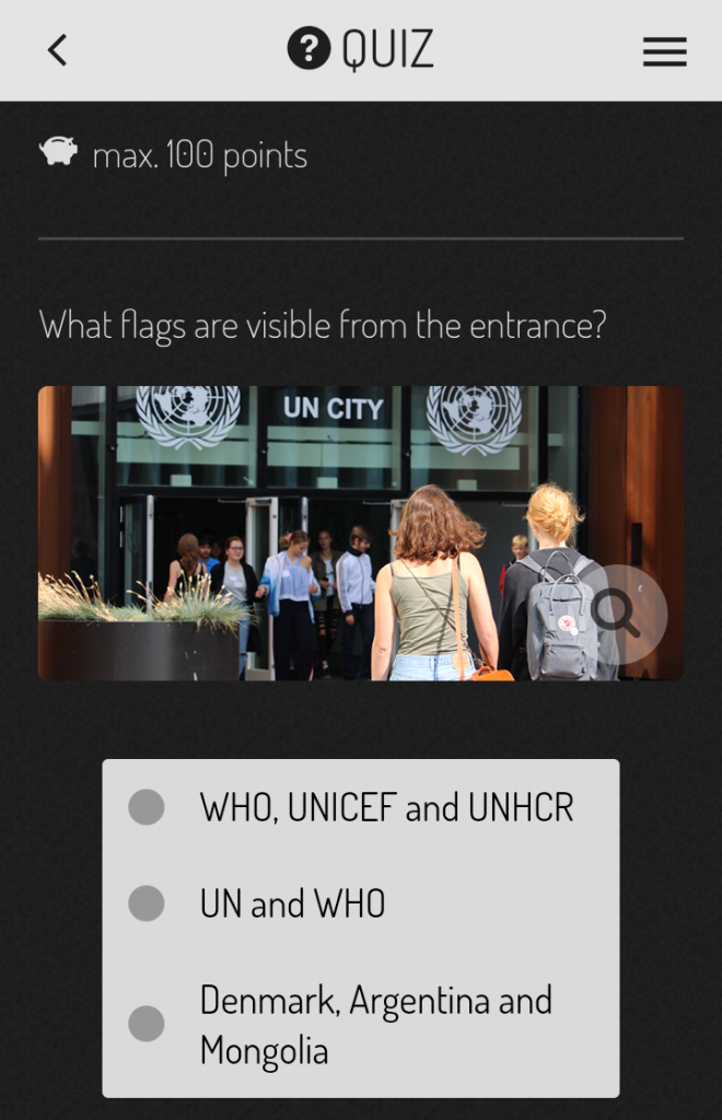
The Quiz option presents another affordance with regards to how the user navigates between digital and physical spaces. In order to gain points and to move on to the next element on this digital media, the user must find out what the answer is by actually researching what the flags waving in front of the building are:

The answer to the quiz, option 2, UN and WHO flags as seen below:

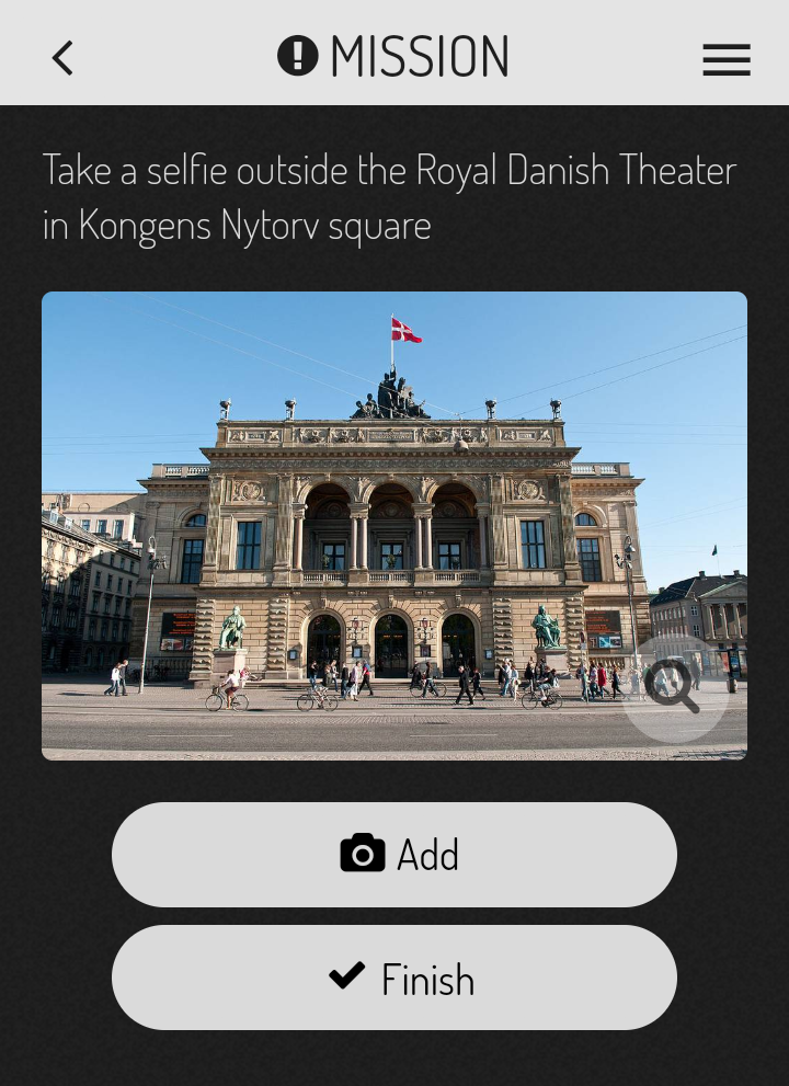
Next stop, another interaction between the physical and digital: uploading a selfie in front of a national landmark:

The following element is the one constraint I found with regards to this exercise which does not necessarily have to do with Actionbound but with digital media as a whole: the dependency on others and how one glitch in the the process can ruin the whole experience. While researching what QR Codes I could include in my story, I came across the Talking Statues project which according to their website: 

“The project Talking statues, which started in Copenhagen today gives the opportunity to some of the most prestigious cultural figures from Copenhagen, Helsinki, London, and Chicago a chance to tell their own history to the passersby.  With the new modern mobile technique, there is a completely unique opportunity for a new form of dissemination of our heritage in urban space through spectacular live demonstrations around the world: The statues come alive and tell their own stories with accurate human voice. In other words, Copenhagen statues and statues around the world are engaged in the new fantasy of the 21st-century mind and imagination, namely, to make possible the impossible through the latest technology!”

An exciting educational addition to my Bound! By scanning a QR code located on the statue, you would learn more about the figure. I remembered the QR code on Hans Christian Andersen’s statue and decided to include that in my project. When I tested the Bound, I encountered my one major frustration and disappointment as I realized the link I was redirected to when scanning the code was no longer working. When interacting with the digital and the physical, there are clearly things beyond my control, and in this case, it’s the Talking Statues project that failed to deliver.

It looked great in Actionbound:

And the QR code was there when I tested it out:

But the link was not working:

I tried again with another statue, but same result:


I was hoping to come up with an alternative solution for the Scan Code element in Actionbound but i did not manage to materialize anything in time. As a result, this element was deleted.

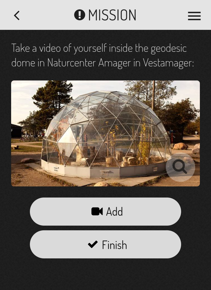
Next stop, the Nature Center in West Amager (Vestamager). An amazing place in the South of Copenhagen, just 500 meters away from the metro station:

And my favorite, the last stop, a video uploaded from inside the dome:

My takeaways from this exercise are as follows:

  1. It was my first experience with locative narrative, or at least, it was with this type of technology. At first I was not entirely aware of the storytelling aspect involved in Actionbound. I had never associated apps like these with actual narratives, and as described in the key reading, an “embedded narrative” (Ritchie 2014, page 58). I know understand how Pokémon Go can be considered an “enacted narrative” (Ritchie 2014, page 58). with it’s tagline or slogan being Get Up and Go, motivating kids (and adults) to interact with their surroundings and with each other through their phones.
  2. The affordances and constraints, as described by Ritchie (2014), which I could identify in  this exercise were mainly related to the functionalities Actionbound has to offer to enable storytelling between the physical and digital worlds. The issue of sequencing and guiding the user through the story, or letting them choose the way the create their own story, is an affordance of the tool. I mostly chose to limit them to ensure they followed a logical path from the UN City to the outskirts of Copenhagen, but I could have set up the narrative in a different way that allowed them to explore freely. This quickly turned into a constraint when realizing that I was forcing them to go through a step that was unsolvable (the QR Code).
  3. With regards to the notion of public space and space is general as described by Berry et. al, it opened up the concept even further. Berry was certainly on to something when he described space as “an imminent field of relations
    that are in constant flux as bodies, material forms and images come into contact.”  (Berry 2013, page 5). This was made evident in this exercise as the user had to constantly navigate and interact with the digital and the physical when moving through public spaces. The reading continues: “Public space more than often functions as a space between the vir­tual and the real, between labor and leisure, between work and home. In urban public space, the technology that sends us off into virtual worlds and the embodied experience of physical and mental meandering all but collide, forming a mise-en-scene that is all montage.” (Berry 2013, page 7). The public space represented through Actionbound by connecting the virtual and the real is even more palpable through this locative narrative. It is not the physical environment dominating here, with sprinkles of digital aspects embedded in the space, but an arguable equal balance of both environments interacting together, one not able to exist without the other in the context of the narrative.

References

Ritchie, J. 2014. The Affordances and Contraints of Mobile Locative Narratives. In The Mo- bile Story. Narrative Practices with Locative Technologies, ed. J. Farman, 53–67. Oxon: Routledge. This is a chapter from this book (with website wher you can download chapters). 

https://en.actionbound.com

Berry, C., Harbord, J. & Moore, R.O., 2013. Public space, media space, Basingstoke: Palgrave Macmillan: 1-15 (Introduction). Berry et al(2013)public space,media space.pdf 

Week 4 – Code/Space

In Wired’s article on The road to tomorrow: streets need to be as smart as the cars driving on them, Luke Dormehl presents the reader with examples of cities smarting up their dumb infrastructures. The ultimate objectives seem to be the usual suspects: reduction of traffic, reduction of cars in the street causing pollution and congestion and increased safety. The articles takes us on a ride though the streets of cities like Copenhagen, Bristol, Boston and the well-known case of Songdo, all working towards the development of smart roads filled with gadgets and sensors to enable smart self-driven cars. The point the article is trying to make (one of them at least, according to the title) is the following: if major cities want their landscapes to resemble the future shown in The Jetsons where the digitization and automation of cars reign supreme, they need to beef up the software ingrained in their infrastructure. What do these relationships mean with regards to the presence of code, its affect on the concept of space (and public space) and the impact on today’s societies?


The future, brought to you by Mercedes Benz

Kitchin and Dodge address the topic of digital cities through a less conventional lens; that of code and the language it uses to create software. Less conventional because code and software are not necessarily the subjects of exciting literature. Code is just not sexy enough to get into the discussion. But it’s about time we shed some light on this silent worker, as software does all the heavy lifting. Through its lines of code and algorithms it orders hardware around, telling it what to do and when to do it. Sometimes in such an automated way that we humans have no interaction whatsoever in the process and no notion of its actual existance. The very notion of public space is affected by code, as Berry points out: “Public space more than often functions as a space between the vir­tual and the real, between labor and leisure, between work and home. In urban public space, the technology that sends us off into virtual worlds and the embodied experience of physical and mental mean­dering all but collide, forming a mise-en-scene that is all montage. (…) The technological and the embodied become just so many reified strips of perception whose arrangement is all but arbi­trary.” (Berry et al., page 7). 

Code is all around us. It is ubiquitous as software is present in our everyday lives, all of the time. It is in our entertainment, our work and our daily operations such as shopping with a credit card. Code creates spaces where we operate and live; it transduces spaces that already exist. “Code/space occurs when software and the spatiality of everyday life become mutually constituted, that is, produced through one another. Here, spatiality is the product of code, and the code exists primarily in order to produce a particular spatiality.” (Kitchin, R. & Dodge, M.,page 16). In this relationship, one cannot exist without the other. The same applies to the smart-coded cars described in Wired and in every other blogpost or article referencing smart cities. These cars, coded infrastructure according to Kitchin and Dodge, are driving on physical streets, also containing software, coming together as coded assemblages that depend on each other to perform. 

The way we move in our cities, the way we understand space is defined by the code that it transduces. However, it is not the software that determines how we as citizens cities should move and function in our cities. It is an actual decision and vision coming from the engineers who programme the code, ultimately from the decision-makers who enable this to happen.

Although software is not sentient and conscious, it can exhibit some of the characteristics of being alive. (...) code can make things do work in the world in an autonomous fashion-that is, it can receive capta and process information, evaluate situations, make decisions, and, most significant, act without human oversight or authorization. (Kitchen and Dodge, page 5)

As Townsend mentions in the Wired article, “Cars didn’t take over the city until cities put rules in place that allowed it. It was a choice that city governments made. That’s one of the things that’s often uninformed about speculation that’s coming out of Silicon Valley now. They think they’re going to solve all the problems the car created by just putting in some software. Its a lot more complicated than that.” (Townsend quoted from  Wired). Software has been referred to as semi-sentient because of its automation capabilities, but this does not go as far as to believe that code is inserting itself in our cities without our human intervention. We might not be aware as inhabitants of a city of how far engrained and present software is around us, but it was purposely put there and that decision has shaped the spaces we inhabit as well as the way we function as a society.


References: 


Week 3 – Data and the smart city: Critical perspectives

A smart city like Songdo screams potential from every angle and perspective. Processes like interactivity and automation through digitalization can improve the daily lives of a city’s inhabitants as they can reduce stress caused by everyday frictions (easy commutes to work), promote diversity (embedding technologies in the city to support people with sight loss) facilitating access to participation and citizenship (through quick and efficient e-government and the use of data for decision-making) and perhaps most relevant in the context of the Agenda 2030, provide the tools for sustainable development (greener approach to waste management). However, according to these articles in the BBC and Le Monde this particular case study of the Korean city of Songdo seems to be more of a lesson learned on how not to conceptualize and develop smart cities.

Every aspect described above that seemed to make Songdo appealing has not effectively materialized as initially planned for this 40 billion dollar city, and furthermore, these aspects of digitalization are not as straightforward as they seem to be. Is Songdo reason for existing only based on embracing technology for technology’s sake? Is the digitalization of a city like Songdo just intended to improve mundane aspects of our lives or are there ulterior implications that affect our citizenship rights and responsibilities?

As insightful as these articles may be, according to various authors in Our Digital Rights to the City and The Spectrum of Control: A Social Theory of the Smart City, there is much more to read and interpret from them than initially meets the eye.

Before diving into the issue of data which is prevalent in this week’s readings, let’s look into some interesting concepts brought to our attention in the news articles, and link them to the readings mentioned above.

Songdo is what Sadowski (The spectrum of control) calls a smart city built from scratch. In this case, a smart city where intelligence is not fostered or collected from its inhabitants but from the digital hardware that make up the Internet of Things. As described by the BBC “And that’s because the city is currently less than half full; less than 20% of the commercial office space is occupied, and the streets, cafes and shopping centres still feel largely empty”.

Going back to last week’s reading on Townsend, “We need to empower ourselves to build future cities organically, from the bottom up, and do it in time to save ourselves from climate change.” (Townsend, page 18)

What Townsend is saying might be easier applied in the case of cities that are retrofitted and renovated from dumb to smart. This is not the case in this city built from scratch where there is no citizenry to begin with. One may argue that faced with the shocking statistics presented by the UN on the exponential growth of cities, countries like Korea are facing this issue head-on, and in a sustainable way, by addressing needs of the present without compromising the ability of future generations to meet their own needs (Brundtwald Report). All of this achieved through the development of green housing and infrastructure.

Sustainability, however, encompasses much more than green development as defined above. This complex and rich concept includes social aspects such as diversity and gender. However, as described in Le Monde,Sterile and soul-less, the city looks different from Korean cities. There are no poor people, no street vendors, no old people.” This sterility embodies not only the absence of people but for those who have decided to call Songdo their home, the lack of diversity which sets the stage for a city that might not be sustainable in the long run for a more varied type of citizenry.

The lack of means of transportation to and from the city are also a concern from a sustainability point of view. As referenced in the BBC article, “Despite being next to South Korea’s main international airport, transport links into the capital itself are rudimentary, and the incentives for companies moving to a new smart city don’t always outweigh the costs.” How is the city expected to grow and to serve the needs of current and future generations if it is being developed without these considerations?

Even with regards to green infrastructure, the city of Songdo does not seem to tackle that issue very smartly, as mentioned in Le Monde, “The buildings are totally transparent and it is impossible to open the windows”. “In summer and winter the air conditioning is on all the time. I wonder if I don’t use more than before”. She herself had not seen the link between smart city and environment.” 

The articles describe a city booming with technological innovation, a digital landscape almost devoid of people. The city’s infrastructure has developed quicker than the actual need and appeal to move to the city, as well as the surrounding infrastructures such as means of transport that connect Songdo to Seoul. Especially in Le Monde’s description, it is an engineers dream of a modern and futuristic city, but ultimately lacking the ability to enable interactions between people and things.

An article in Datafloq further describes the big data capabilities of Songdo and the promises it intends to deliver. According to the article, surveillance and traffic control are obvious reasons behind data monitoring, but Songdo aims for more. Climate, energy consumption, leisure activities and water consumption will be monitored by data capturing systems. These systems feed off of people and their activities, habits, actions. Companies might understandably not feel compelled to move their operations to Songdo, especially considering the promises of surveillance and data monitoring are not quite appealing in city with a population less than half of the originally intended.

According to Le Monde: “Songdo is also a town under constant surveillance: 500 cameras ensure total grid coverage to regulate the traffic or detect ‘suspicious’ behaviour. Even the opening of a sewer cover is immediately notified to the IFEZ management centre in one of the towers in Songdo. “We work in close collaboration with the police, but the data are not kept for more than thirty days”.

This last comment regarding data used for policing ties strongly to Sadowski’s section on The hard power of policing technologies. Smart cities are relying in technology and big data with the excuse of using non-violent means for crowd control and ensuring the safety of their citizens. But “technological means threaten to even prevent crowds from forming in the first place, thus moving from reactionary to prophylactic strategies.” (Sadowski, The Spectrum of Control). The use of big data to justify decisions without context or knowledge of historical patterns or trends might result in dangerous and unjust rulings and also go against a citizen’s basic right to assemble and protest.

The infrastructure in Songdo is laid out for data collection in every front, however, the issue of consent is a prevalent one in discussions regarding the use of big data by governments and organizations. Sadowski warns future architects of smart cities “without consistent citizen consultation and serious penalties for misuse of data, their apparatus of omniveillance could easily do more harm than good.” But even before addressing the issue of consent, when building a city from scratch like Sondgo, government officials, town planners and engineers should keep in mind that every city requires its citizenry to exist. Cities require people’s empowerment and participation to make the city before making the data. As Sadowski says “We make the city, and the city makes us. In a time when the urban environment is crisscrossed, undergirded, and overlaid with digitality, the corollary is: We make data, and  data makes us. We thus have—and must claim hold of—“the right to command the whole urban process.” (Sadowski, page 10-11)

Shelton continues this line of thought by referring to a process of knowledge production within cities that start from the ground up: “In order to attain the right to both participation in, and appropriation of, the city, citizens must be free to understand the city and construct their own knowledges and representations of it.” (Shelton, page 27)

Participation and community engagement are also building blocks of sustainability, and in the world we are living in with a growing population and unprecedented development, the digitaliization of cities, either from the ground up or as a transition from dumb to smart, should take these perspectives into consideration.

References:

Sadowski, J (2017) ‘Access denied: Snapshorts of exclusion and enforcement in the smart city’ in Shaw, J and Graham, M. ed. Our Digital rights to the citypp 6-11. Meatspace Press [Free access, available to download, read online or self print]

Sadowski, J. and Pasquale, F. (2015). The Spectrum of Control: A Social Theory of the Smart City.’ First Monday 20(7): Available at URL: http://firstmonday.org/article/view/5903/4660

Shaw, J and Graham, M (2017) ‘An informational Right to the City?’ in Shaw, J and Graham, M. ed. Our Digital rights to the city, pp. 1-5. Meatspace Press [Free access, available to download, read online or self print]

Shelton, T (2017) ‘Repoliticizing data, in Shaw, J and Graham, M. ed. Our Digital rights to the citypp 24-27. Meatspace Press [Free access, available to download, read online or self print]

Townsend, A.M., 2013. Smart Cities, New York: W. W. Norton & Company. xi-18. 

BBC 2013 Tomorrow’s cities. Just how smart is Songdo?  (2/9/13) http://www.bbc.co.uk/news/technology-23757738

Le Monde 2017 Songdo, a city for the affluent http://www.lemonde.fr/smart-cities/article/2017/05/29/songdo-ghetto-for-the-affluent_5135650_4811534.html

The Smart City Of The Future Will Bring Big Data To A New Level https://datafloq.com/read/smart-city-future-bring-big-data-level/183

Report of the World Commission on Environment and Development Our Common Future http://www.exteriores.gob.es/Portal/es/PoliticaExteriorCooperacion/Desarrollosostenible/Documents/Informe%20Brundtland%20(En%20ingl%C3%A9s).pdf