
Cities are the place where mobile systems and technologies rule together thanks to an understated structure of monitoring and surveillance. Elliott and Urry overpass Bourdieu’s notion that cultural and economic capital coexist in the city, by adding a third one, which they call ‘network capital’. From their words, the “network capital is largely subjectless, communications-driven and information-based” (Elliott and Urry, 2010, p.11). In fact, the future world scenario of the “Digital Networks” is greatly based on intelligent softwares.
These digital machines are activated in order to help the daily errands of citizens from controlling and recording data to securing a safe passage by using CCTV cameras. Others may be dedicated to check someone’s route and to track various information. Hence, it is a never-ending stream of different individual and group data that has been recorded. Consequently, the first ethical problem regards civil liberties. Are they threatened or not? Elliott and Urry define it as a “digital ‘Orwellian-ization’ of self and society, with more or less no movement without digital tracing and tracking and with few legally beyond or outside the control of digital networks” (Elliott and Urry, 2010, p.150).

Right now, Mapping for Change is an organization that works to “provide benefit to individuals and communities from disadvantaged or marginalised groups, along with the organisations and networks that support those communities, where the goal is to create positive sustainable transformations in their environment” (Mapping for Change, Our Company, 2008-2016, http://mappingforchange.org.uk/our-company/). Through the years they have developed an agenda with various projects.
One is called MyAccessible.EU, funded by the European Union, where specific instruments will have the function of “collectively gathering and sharing information about accessibility of public spaces” (Mapping for Change, MyAccesible.EU, 2008-2016, http://mappingforchange.org.uk/projects/myaccessibleeu/ ).
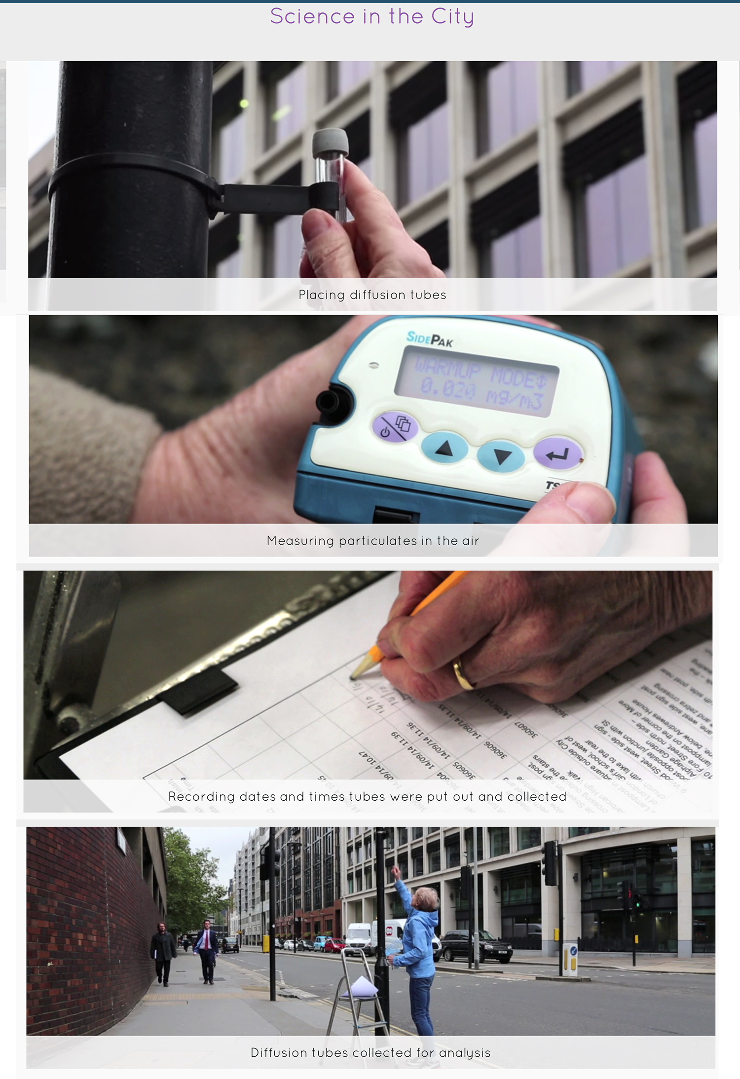
Another one, “Science in the City” is a location-based project where Londoners resident in Barbican and Mansell Street are given low-tech tools to measure the quantity of Nitrogen Dioxide and other substances present in the air. By doing it, people participate in taking active control over some important issue of their city. These sensors go under the categories of the Digital Network scenario and they can be positively useful when they led a group of residents to cooperate in maintaining their own city accessible and reachable.
References
Elliot, A & Urry, J. ,2010, Mobile Lives, pp. 1-23, 131-154. Routledge.
HackAIR., 2016, Available at: http://www.hackair.eu [Accessed 2 May 2016].
Mapping for Change, 2008-2016. Available at: http://mappingforchange.org.uk [Accessed 2 May 2016].
Mapping for Change, MyAccesible.EU, 2008-2016, http://mappingforchange.org.uk/projects/myaccessibleeu/ [Accessed 2 May 2016].
Mapping for Change, Our Company, 2008-2016, http://mappingforchange.org.uk/our-company/ [Accessed 2 May 2016].