Productive Urban Landscapes

Research and practice around the CPUL design concept

Illustrated map showing the area of Southeast False Creek. (Source: City of Vancouver, 2022)

South-East False Creek, Canada

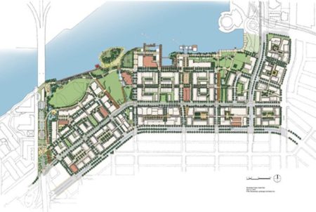
The Southeast False Creek neighbourhood of Vancouver is one of the last remaining brownfield waterfront development sites in the city. Taking up 80 acres and being developed to become home to 16,000 people, this neighbourhood development models how cities can incorporate urban agriculture in high-density, high-rise development areas. The urban agriculture strategy for Southeast False…

Continue Reading

Map of the South-East London Green Chain (Source: Gov.Co.Uk, 2022)

The South-East London Green Chain, UK

The South-East London Green Chain was created in 1977 by the Greater London Council and four London boroughs – Bexley, Bromley, Lewisham and Royal Greenwich in order to protect the green areas from inappropriate building. Today it includes a fifth borough – Southwick – and links over 300 open spaces. The spaces are a combination…

Continue Reading

1 5 6 7